|
ArcView and ESRI Information
|
|
ESRI is one of the leading manufacturers of Geographic
Information Systems software (GIS). Their software includes programs like
ArcInfo and ArcView as well as dozens of other programs. ESRI
programs can be very useful for cave surveyors, land managers and other people
who need to evaluate cave and karst areas in relation to geological and
geographic information. For this reason, Compass provides special tools for
integrating cave data with GIS programs. |
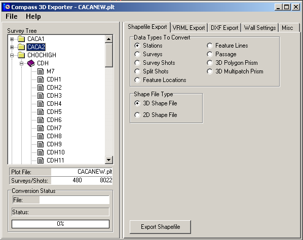 |
| 3D Exporter. The
Compass 3D Exporter can convert cave data to Shapefiles, DXF files or
VRML files. Shapefiles can be read by many different GIS programs
including ESRI programs such as ArcView. The Exporter can generate nine different types of shapefiles
including 3D passage modeling. |
|
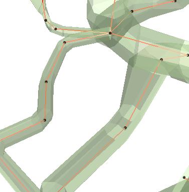 |
Passage Modeling. The image
to the right show typical cave passage displayed in ArcView 3D Analyst.
The shots are shown as red lines, the stations as black dots and
passages as transparent green solids.
|
|
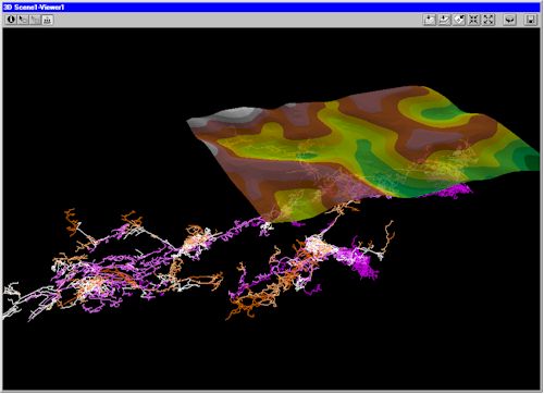 |
| Surface Terrain. Here is an
example showing Lechuguilla Cave with the surface terrain overlaid as It is a good example showing
what can be done with ArcView using COMPASS data files.
|
ESRI Support. ESRI has been very supportive
of cavers, and cave conservation. They have also very supportive cave survey
programmers and cartographers. They even have their own web page devoted
to supporting and encouraging cave and karst issues. Here is a link to
ESRI's Cave and Karst web page:
ESRI's Cave
and Karst Web Page
|
|
Free Software. ESRI also provides free software and
trial versions that can be very useful to cavers:
-
ArcExplorer.
ArcExplorer is a free viewer that is available from ESRI. It allows you to
view Shapefiles and many other data types including maps, images and aerial
photograph.
-
ArcView 60-day
Trial. ArcView is the main GIS product from ESRI. This 60-day trial
version allows you to experiment with cave data and GIS.
|
|
CaveTools. Because Shapefile Export is now a part of Compass, Cave
Tools is no longer available. Nevertheless, ESRI continues to support the caving
community many important ways. One of the biggest supporters of cavers at ESRI
is Bernard Szukalski. He has always been very supportive of my work and the work
of other cave-survey programmers. Here is a link to Bernie's web page:
-
Berie Szukalski Web Page.
ESRI has been a big supporter of cave-relative projects and Bernie has been
the main driving force behind that support. This is a very nice web page
with lots of interesting cave-related information.
|

