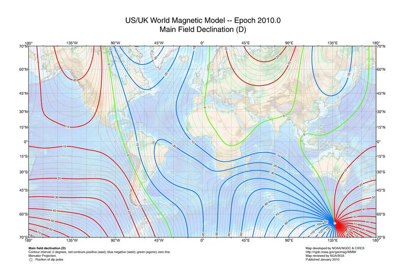
The earth’s magnetic field has a North and South Pole that does not exactly match the real North and South Pole. As a result, a compass will not point exactly at true north. Depending on where on the globe, the magnetic pole may appear to the right or left of true north. In addition, the magnetic poles gradually wander over time. This means that over a period of years, the direction of magnetic north will slowly change. As a consequence of these effects, the direction of magnetic north will depend on where you are and what year it is. Here is a map of the world magnetic declination for 2010
Declination. The difference between magnetic north and true is called declination. This angle can be used by Compass to correct a cave plot so it is aligned to true north. This is especially important for large cave systems that are surveyed over several years because the magnetic north can change as different parts of the cave are surveyed. This can cause large loop closure errors between different sections of the cave.
Magnetic Models. Magnetic declination can be measured for a particular time and place by sighting the North Star and comparing that line with magnetic north. For cavers, this is impractical because you have to do around the same date you are surveying. It also requires a clear night sky, an obstructed view of the North sky and certain instruments.
To solve this problem, Compass uses a mathematical model of the earths magnetic field. This model allows you to find the magnetic declination for any location in the world on any date. The date can be in the past and the model can also predict any date up to five years into the future.
Currently, the program can give you declinations for any date between 1900 and 2020. The program will also give you values for dates outside this range, but the accuracy deteriorates as you move beyond this range. In the future, as new models are released, they will be incorporated into Compass.
Warnings. You should be aware that local anomalies can distort the magnetic field and change the declination. For example, minerals in the subsurface, power lines, and geologic faults can create local disturbances to declination. For this reason, the best way of find the true declination is to setup a survey standard near the cave. One way to do this would be to set up two permanent markers aligned to true north. By periodically testing compasses against the standard, you find local declination and also find errors in the instruments.
Technical Details. There are several magnetic models that are used to model the earth’s magnetic field and thus calculate declinations. Compass uses the “International Geomagnetic Reference Field” (IGRF) model for future predictions and the “Definitive Geomagnetic Reference Field” (DGRF) model to calculate past declinations. The software has been carefully tested against the government standards. Here is a link to more information:
http://www.ngdc.noaa.gov/IAGA/vmod/index.html