Compass allows you to import images, drawings and photographs into the Viewer and use them as a background to your cave plot. In effect, this means that you can plot your cave on top of any image. For example, you can import a scanned image of a topographic map or aerial photograph and superimpose the cave on top of the image. This would allow you to see where the cave passages lay in relation to the surface terrain.
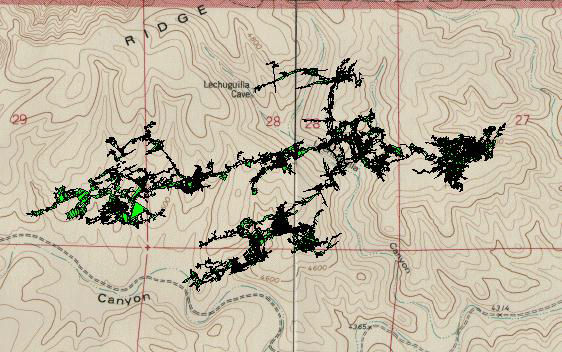
Once an image has been loaded into the Viewer, it can be locked into position so that it tracks the panning, zooming and rotating of the plot.
Here are detailed about the process and options: