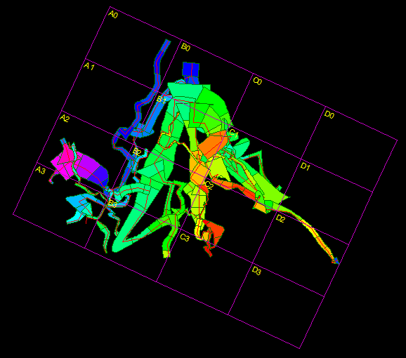
When you are working with large caves, it is often useful to break the map up into smaller segments. This allows you to create more detailed maps of the cave. It is also useful for group projects because each segment can be assigned to a different person. These map segments are usually called Quad Maps.
Quad Maps. The Viewer generates Quad maps by superimposing a grid of rectangles over the cave. The number, size, location and rotation of these rectangles can be controlled so that any conceivable pattern of Quads can be created. Each rectangle can be labeled as to its row and column. You also have complete control over how each rectangle is labeled. Because of the fact that the quad grid is precisely tied to the cave, the grid can be recreated at any time to produce new maps.
Enabling Quad Maps. To enable Quad Mapping select the "Display->Show->Show Quads" option from the menu bar. When the Quads option is turned on, a grid of rectangles will be drawn covering the cave. |
|
Controlling Quad Attributes. To set the attributes of a Quad Map, select the "Preferences->Set Quads" option from the menu bar. This will display a window that allows you to control all aspects of the Quad grid. The window is divided into three pages. You can select each page by clicking-on the tabs at the top of the window. Here are detailed descriptions of each page:
Saving Quad Settings. Once you have set the orientation and size of your quads, you can save these settings using the "Views" feature. You can also change the color of the grid lines or the font used to print the labels using the Colors and Fonts Window