These images show example
of overlaying the terrain models with topographic maps, aerial
photographs and even drawings.
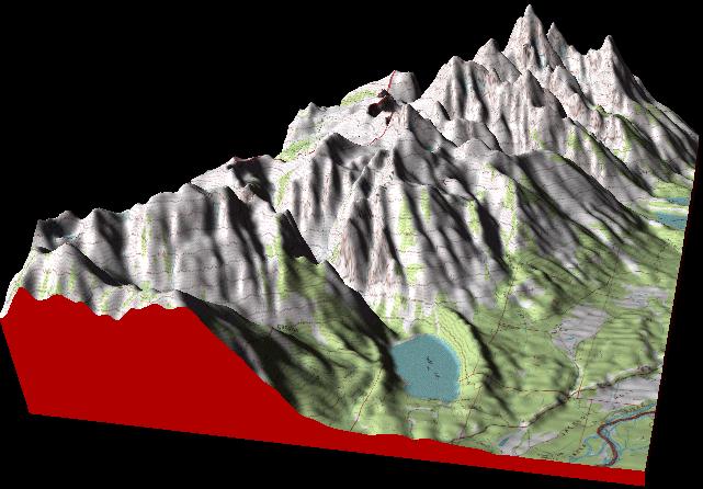
Example 1. - Grand Tetons
- Topomap Overlay
This image show the Grand Tetons in Wyoming, viewed from the southwest. The
terrain has been overlaid with the USGS 7.5 minute topographic quadrangle
for the area. The sun set so that it is low in the sky to the west giving
deep shadows in the canyons.
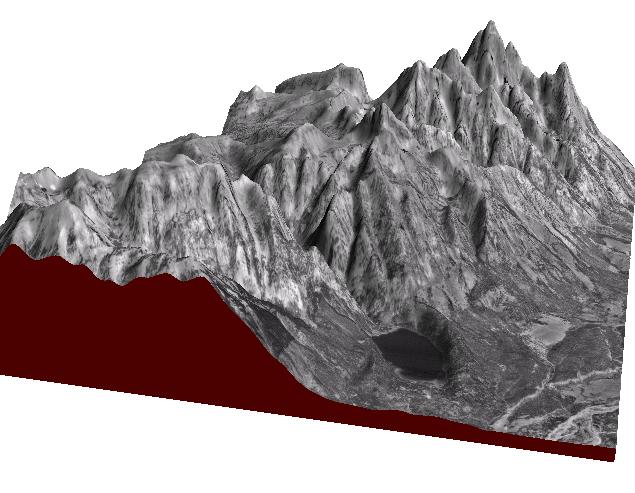
Example
2. - Grand Tetons - Aerial Photo Overlay
This image shows the same terrain
as the first image except that it has been overlaid with a
black-and-white aerial photograph. The photograph was a USGS Digital
Raster Graphics (DRG) aerial quad image. With these photographs you
can see individual trees if zoom close enough.
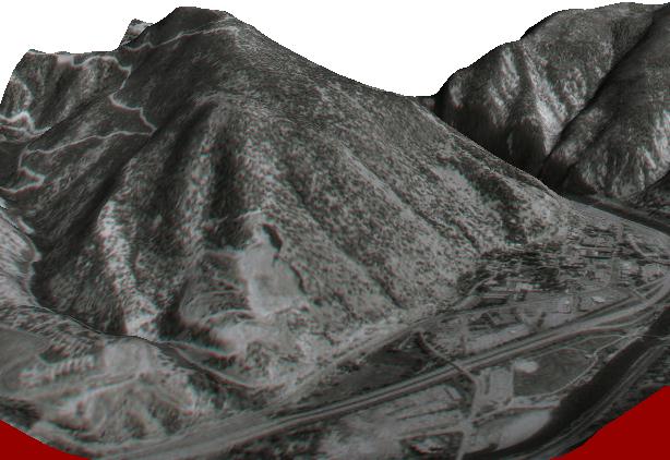
Overlay Example 2. - Glenwood Springs, Colorado
This is an image of the terrain around Glenwood Spring, Colorado. All
this was done by overlaying the terrain with a relatively low resolution
photograph downloaded from the internet. Higher resolution photos give much
clear images. You can see the Interstate-25 in the foreground. The town of
Glenwood is to the right and Glenwood Canyon is in the upper right. With
Estierra, you can fly up and down the canyon as if you were in an airplane.
The mountain on the upper left has a quarry at its base and road winding up
the backside.
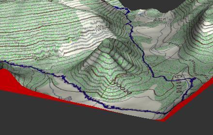
Overlay Example 3. Lines, Trails and Notation.
This image illustrate the ability to put your own notation,
lines, trails and other information on top of the terrain. Here a
mountain biking trip is marked as a blue line superimposed on a
topographic map. Since the overlays are normal bitmaps, you can draw or superimpose any graphics you want on
the terrain models.