|
COMPASS Printer Preview Screen |
|
Printing a cave on a piece of paper is very different from viewing the cave in a
window. This is because the size and dimensions of the view screen are very
different from the size and dimensions of printer or plotter paper. As a result,
COMPASS has a special preview screen that displays a scale model of what the
printout will look like on your printer.
|
 |
|
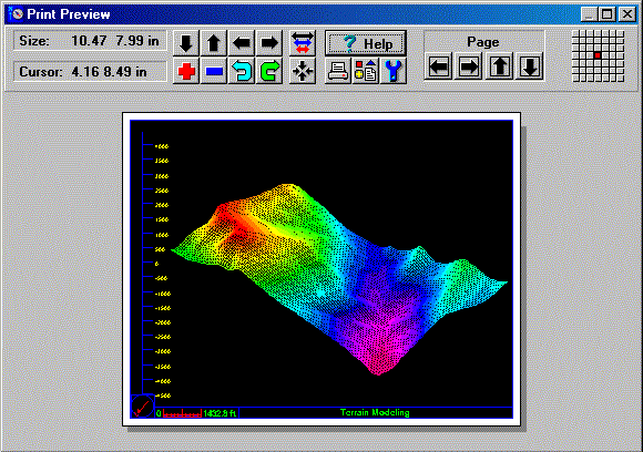
As you can see, the preview screen displays a simulated piece paper. The
paper size and the plot are an exact scale model of the actual printout.
If your printer supports color, the preview will appear in color.
The preview screen was specifically designed to for cave surveying and it
has features that allow you to adjust and position the image without going
to a different screen. The tools along the top of the screen allow you to
perform precision pans, zooms, and scaling. Arrow icons allow you to pan,
move and position the plot. The plus and minus icons allow you to change
the scale by zooming in and out. The other arrows allow you to move by a
whole page for multi-page plot. The red dot in the grid in upper right shows
which page you are printing in a multi-page plot. The rest of the icons allow
you to setup the printer, select a different printer and configure the plot.
The box in the upper left shows the size of the plotting area on the paper.
The next box show the cursor position on the simulated piece of paper. The
position is displayed in millimeters or inches, and it is scaled to match
the scale of the simulated paper. This is very useful for precisely positioning
labels, passages and legends on the paper. |
|
MULTIPAGE PREVIEWS. |
|
When you print a cave at a scale where the image
will require more than on page, it can be difficult to align the different
parts of the image to different pages. For this reason, COMPASS gives you
the option of displaying multiple pages in the Print Preview screen. In this
way, you position subsections of the cave in the precise position you want
for each page. You can also print all the pages at once. |
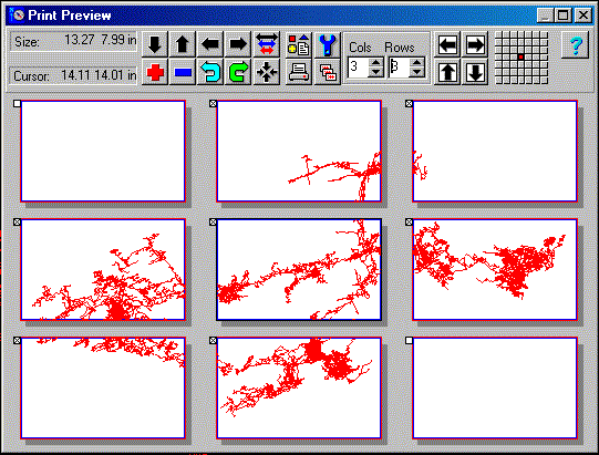 |
| This image shows the Print Preview screen with nine pages displayed.
Here the printer is set
to Landscape Mode with 8.5 x 14 paper so the pages are scaled so they match
the paper
size. The "Cols/Rows" display controls the number of pages that will be
displayed. The
checkboxes in the upper left-hand corner of each page control which pages
will be printed.
Here, the two blank pages will not be printed. |
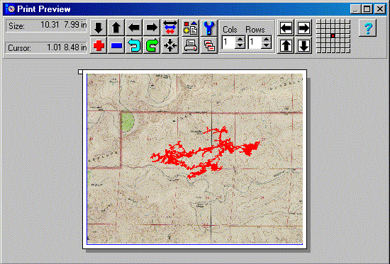 |
| This image shows how the Preview Screen can even display complex color plots
and bitmap
bitmap background images. In other words, with the Preview Screen, what you
see is truly
what will be printed. |
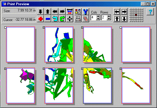 |
| This image shows one of the color passage modeling modes printed
across several pages. Here, the printer is in Portrait Mode, with 8.5 x
11 inch paper. |
|
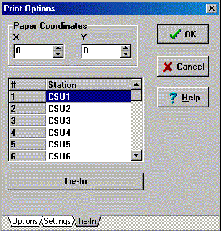
LOCKING THE CAVE TO THE PAPER. |
| One of the more useful printing features of COMPASS is the ability to
tie plots to specific locations on paper. The image to the right illustrates
this capability. With this feature, you can force any station in the cave
to be plot at any location on the page. In other words, you can set the exact
location of where a survey station appears on the page, regardless of the
scale, rotation or view angle of the plot. This is useful for creating quad
maps, atlases and publications.
In order to tie a station to a location on the paper, you must specify the
location and the survey station. You specify the location by entering the
X and Y coordinate in the two spin boxes at the top of the page. The location
is specified in inches or millimeters from the lower left corner of the page.
|
 |
|
|
Other options include the ability to use thicker lines for the printer (printer
lines are much thinner than screen lines), the ability to control the amount
of overlap between adjacent pages, and the ability to printer borders or
corner registration marks for aligning multi-page plots.
|

