| Images from Cavebase the cave database program.
|
|
COMPASS now has its own database program called CaveBase.
CaveBase allows you to create your own databases of cave features.
For example, you can keep track of the minerals, water, life forms, leads,
chemistry, temperature, wind direction, rock type, stratigraphy, passage size,
formation types, PH, etc.
Once you have created a database of cave features, CaveBase has its
own specialized query builder that allows you select specific sets of data
using sophisticated SQL query commands. The results of your queries can be
immediately viewed as colored symbols in the Viewer. If the features in your
database have numerical values associated with them, the symbol's size can
be used to reflect the magnitude of the value. You can also ask complicated
questions about how different data items relate to each other. For example,
you could look for combinations of items like life forms near water.
CaveBase can access any standard Windows database data including DBase, Paradox,
FoxPro, InterBase, MS Access, and through ODBC many others. It can also create
new databases without any other database software. You can even incorporate
photographs and drawings into the database to create a visual record of the
features in a cave.
|
|
This image shows the data entry portion of CaveBase.
|
|
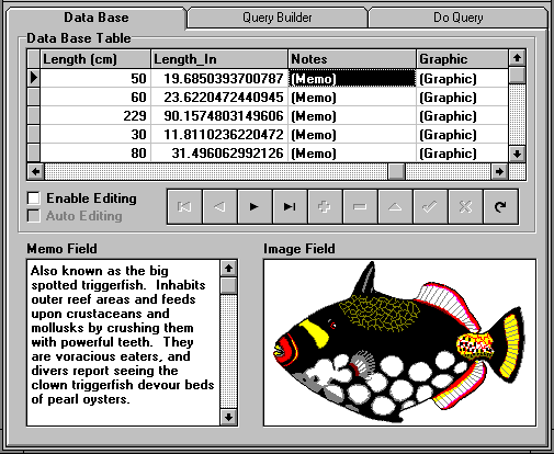 |
As you can see the program allows you archive all kinds of data including
images, photographs and drawings. The images can be copied from the Windows
clipboard or read from a file. The program has advanced database features
including the ability to copy data bases, use an existing database as a template
for a new database and protected editing.
|
|
This is image shows the CaveBase Query Builder. |
|
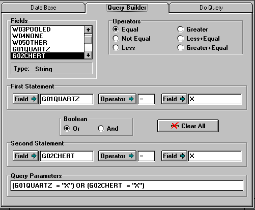 |
The Query Builder allows you search through the database for particular features
in the cave. You can search for complex combinations. For example, the query
displayed on this screen searches the Wind Cave database for stations with
the combination of quartz and chert.
|
| This image shows the CaveBase Query Screen
|
|
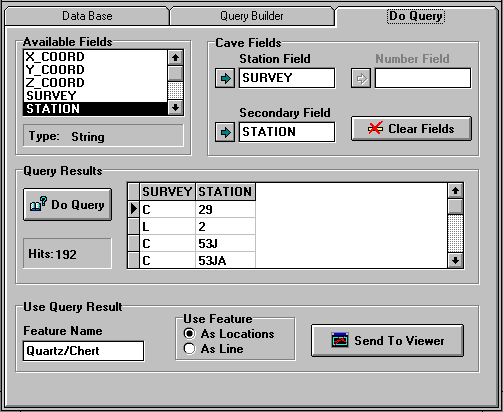 |
Once you have created a query and submitted it to CaveBase, the program returns
a list of all the stations that match the query. This list can then be
transmitted
to the Viewer for display.
|
| Image showing the result of a query as displayed in the Viewer.
|
|
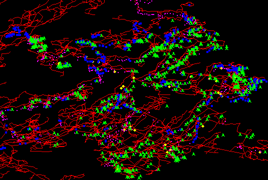 |
This image shows the Historic section of Wind Cave and displays the result
of a complex query. The purple dots show the location of quartz in the cave,
the blue dots show the location of chert in the cave and the green symbols
show the location of paleo-fill in the cave. With a cave database, you can
keep track of the location and value of hundreds of different types of features
in the cave. As an example, the Wind Cave data base tracks 97 different types
of features in the cave.
|
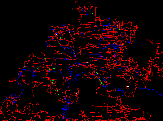
| Line Marking Capabilities |
|
 |
|
This image shows the line marking capabilities of CaveBase. Here is an image
of the Historic section of Wind Cave showing Quartz in white, Chert in green
and Manganese in blue. The line marking feature is used where you have a
large number of features and the map would get cluttered if you marked them
with a symbol.
|

