| Locating and Identifying Surveys
and Stations |
| In a large cave, you can have thousands of stations and hundreds of
surveys. Locating a single station or survey can be very difficult. At
the same time, it can be very difficult to identify which survey you are
looking at when you are zoomed in on a mass of passages. |
|
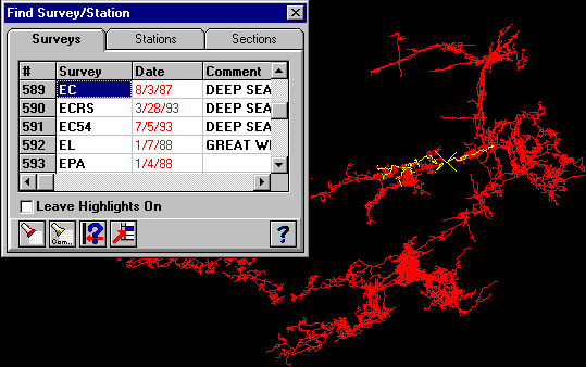 |
| This image illustrates the survey/station location process. Here I
have located the beginning of the Western Borehole in Lechuguilla by
clicking the mouse on the passage and pressing the search button. The
program locates the survey and station closest to the cursor and
highlights them in the plot. It also highlights the survey and station
in the survey list. Here the survey turns out to be the EC survey. You
can also click on any survey or station in the list, and the highlight
will shift to that survey and station. You can also search the survey
and station list and transfer located surveys to the Complex Plotting
Dialog for more complex highlighting. One of the most useful features
is the ability to center the display on a single station or single
survey. Since the display is centered in 3D, when you rotate, the image
always stays centered on the station or survey. This is useful when you
are focusing on a particular part of a cave. |
|
Right Click Menus |
 |
|
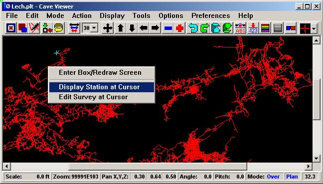
Right-click menus allow you to quickly identify
stations and edit surveys based on the cave
passage under the cursor. (You will also notice
the scroll bars on the side of the window. This
is a minor improvement that makes it easier to
view a specific part of the cave when the window
minimized.) |
|
Identifying Stations and Surveys. |
 |
|
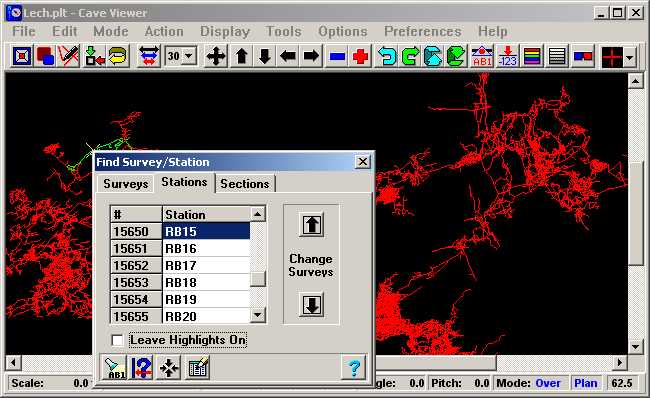
This image illustrates the
option of identifying the station under the
cursor. Here we have identified the RB15 station
and the rest of the survey is highlighted in
yellow. You also have a list of the stations in
the survey and list of surveys and sections in
the cave. |